


PROSPECT Voting District, Butler County, Pennsylvania
About
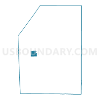
Outline

Summary
| Unique Area Identifier | 657958 |
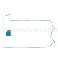
| Name | PROSPECT Voting District |
| County | Butler County |
| State | Pennsylvania |
| Area (square miles) | 4.08 |
| Land Area (square miles) | 4.08 |
| Water Area (square miles) | 0.00 |
| % of Land Area | 100.00 |
| % of Water Area | 0.00 |
| Latitude of the Internal Point | 40.89921280 |
| Longtitude of the Internal Point | -80.04865030 |
Maps

Graphs
Select a template below for downloading or customizing gragh for PROSPECT Voting District, Butler County, Pennsylvania


Neighbors
Neighoring Voting District (by Name) Neighboring Voting District on the Map
- CONNOQUENESSING TWP Voting District, Butler County, PA
- FRANKLIN TWP Voting District, Butler County, PA
- LANCASTER TWP Voting District, Butler County, PA
- MUDDYCREEK TWP Voting District, Butler County, PA
Top 10 Neighboring County Subdivision (by Population) Neighboring County Subdivision on the Map
- Connoquenessing township, Butler County, PA (4,170)
- Franklin township, Butler County, PA (2,620)
- Lancaster township, Butler County, PA (2,532)
- Muddy Creek township, Butler County, PA (2,254)
- Prospect borough, Butler County, PA (1,169)
Top 10 Neighboring Place (by Population) Neighboring Place on the Map
Top 10 Neighboring Unified School District (by Population) Neighboring Unified School District on the Map
- Butler Area School District, PA (54,849)
- Seneca Valley School District, PA (46,966)
- Slippery Rock Area School District, PA (20,583)
Top 10 Neighboring State Legislative District Lower Chamber (by Population) Neighboring State Legislative District Lower Chamber on the Map
Top 10 Neighboring State Legislative District Upper Chamber (by Population) Neighboring State Legislative District Upper Chamber on the Map
- State Senate District 40, PA (256,162)
- State Senate District 50, PA (235,966)
- State Senate District 21, PA (235,571)
Top 10 Neighboring 111th Congressional District (by Population) Neighboring 111th Congressional District on the Map
Top 10 Neighboring Census Tract (by Population) Neighboring Census Tract on the Map
- Census Tract 9110, Butler County, PA (6,278)
- Census Tract 9118, Butler County, PA (6,189)
- Census Tract 9111, Butler County, PA (4,698)